
News
MEMOLab and FUNCI in a research project on the hydraulics of the Tagus River
Sep
Archaeologists from the University of Granada and the Centre for the Study of Islamic Toledo start a study, promoted by the Regional Government of Castilla-La Mancha, on the hydraulic heritage of the Tagus River in Toledo.
The Biocultural Archaeology Laboratory of the University of Granada (MEMOLab) and the Centre for Studies on Islamic Toledo (CETI), of the Islamic Culture Foundation (FUNCI), are launching the project Hydraulic heritage and landscape on the banks of the Tagus. Toledo seen through its river (PaTo), thanks to the subsidy from the Junta de Comunidades de Castilla-La Mancha for carrying out research projects on archaeological and paleontological heritage in the region.
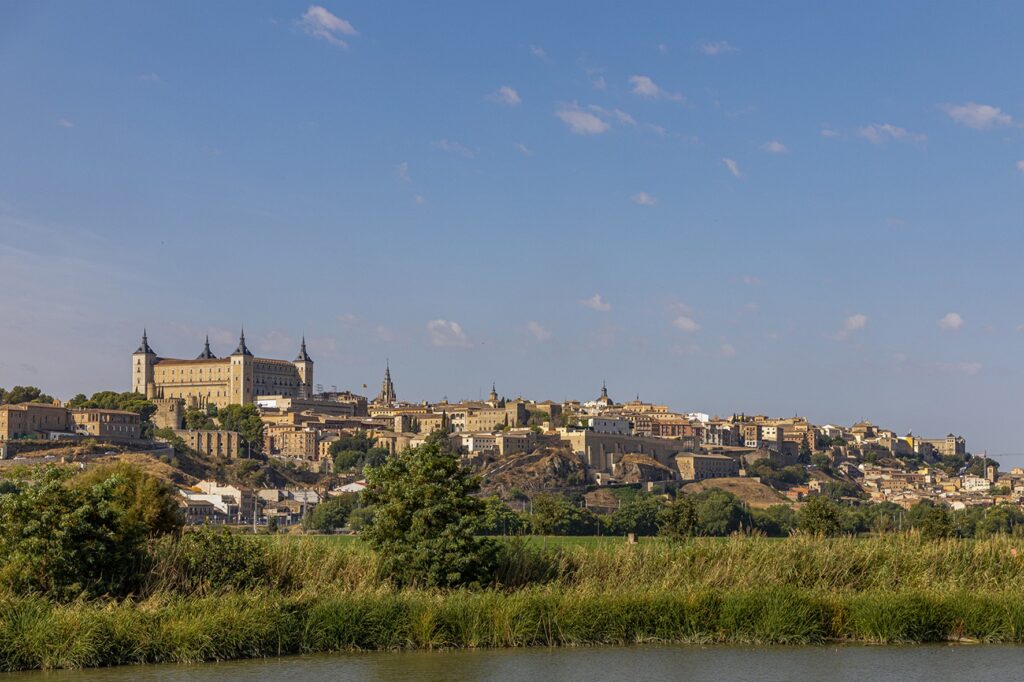
The general objective of this study, directed by Professor José María Martín Civantos (UGR), is to obtain information on the historical water management and handling systems in the area around the city of Toledo, based on the identification of the hydraulic structures associated with these systems. The study area focuses particularly on the river course between La Alberquilla and the Fábrica de Armas.
For the human communities that have inhabited the city of Toledo throughout history, the presence of the Tagus River has been a determining factor, given that their interactions with the landscape have been marked by this geographical feature. It could even be said that, since the first documented settlements, its course and morphology have defined the habitable spaces and their perception, both in the socio-economic dimension and in the more symbolic one.
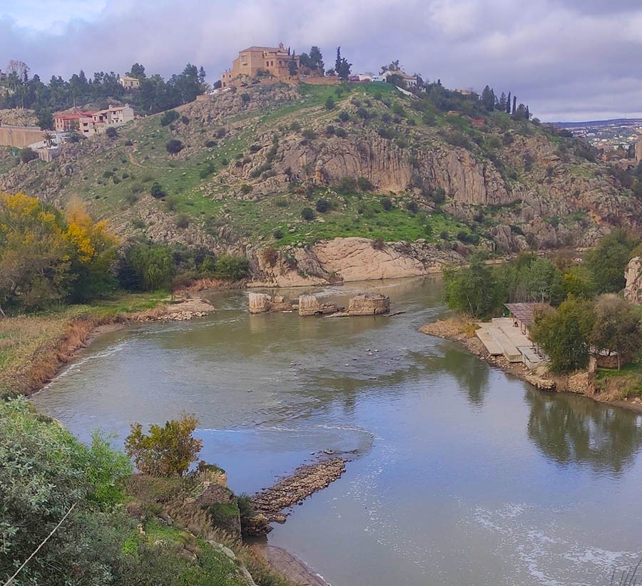
From the perspective of material culture studies, the Tagus river can be understood as a historical agent which, with its characteristics, has exerted its influence on past societies. The hydrographic features of the river, like any body of water, are variable depending on seasonality or other climatic conditions – or anthropic conditions, as in the case of its level of pollution in recent times -, and this capacity for action (agency) must necessarily enter into dialogue with human activities in a constant bidirectionality: the river is both conditioning and conditioned. Thus, in order to incorporate it into their social fabric, these populations used different structures whose materiality can be traced today – in a better or worse state of conservation -.
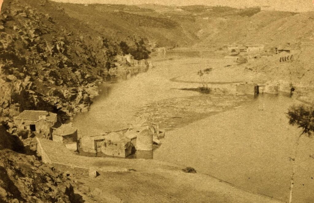
The hydraulic elements that are the main focus of interest in this project have been located along the course and banks of the Tagus, forming an archaeological continuum for the current research, both horizontally – the structures are arranged at different heights along the riverbed as it passes through the historic city – and vertically – the architectural stratigraphy shows the reuse of each structure according to the needs of its context – and the purpose of its mechanisms appears to be considerably diverse chronotypologically -from the flour mills and the artifice of Juanelo Turriano to the hydroelectric power stations-, in such a way that river and hydraulic engineering define, in turn, the range of social processes that, in diachrony, have been carried out through the use of water.
The complexity of this network made up of human communities, their techniques and the river must be rigorously covered by Landscape Archaeology in order to gain a better understanding of the social implications that have historically derived from interacting with the Tagus. In this sense, the material remains can help to discern, among other questions, who promotes hydraulic projects, whether their promotion implies the control of resources -and the consequences of social stratification that this entails-, what activities derive from the structures and what relationship they have with the space where they are carried out, or what repercussions the efforts to relocate water as a resource have on the landscape.
The data and interpretations collected throughout the project can be of great interest to understand how the level of involvement of the city with the river has varied and can help to assess the current situation, so that the research work can support the social agents who strive for the correct conservation of the landscape and its heritage elements. We hope to be able to make all our results available to any entity interested in this aspect.
This article is available in Español